Geoida is a software product that will benefit members of the surveying and related professions for the day-to-day routine processing, coordination and adjustment of spatial survey data, from routine pick-up surveys to complex networks of geodetic scale.
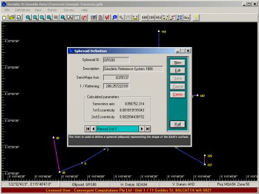
Developed particularly for Australian requirements but with global application, Geoida uses rigorous geodetic formulae to coordinate points using user-definable parameters for any spheroid, geodetic datum or Transverse Mercator projection. Geoida reduces field observations, performs least-squares network adjustments including combined GPS and terrestrial observations, and converts and transforms coordinate data between different datums and systems. It also extracts and reports inverse details and exports point data in various formats suitable for other software. And it can also compute on the plane if required.
Comments